Walking in the Peak District: Hope - Edale - Bamford with plenty of snowy hills in between!
Two days of beautiful walking around Edale in the snow stopping off at Edale Youth Hostel for a night. Day 1: Hope train station - Losehill - Mam Tor - Edale YHA. Day 2: Edale YHA - Kinder Scout (Jubilee Stone) - Hope Cross - Win Hill - Bamford train station.
Day 1
The Hope Valley is easily accessible by train from Nottingham and the transpennine express from Sheffield towards Manchester may be my favourite train journey ever. It’s fantastic to leave the city behind as you enter a tunnel and then after a few minutes - as if by magic - you emerge from the tunnel in the open clear hills of the Peak District. The landscape is beautiful out there; the hills each have their own characters and stories - from the little two-carriage slow train you see it all unfold. Awesome.
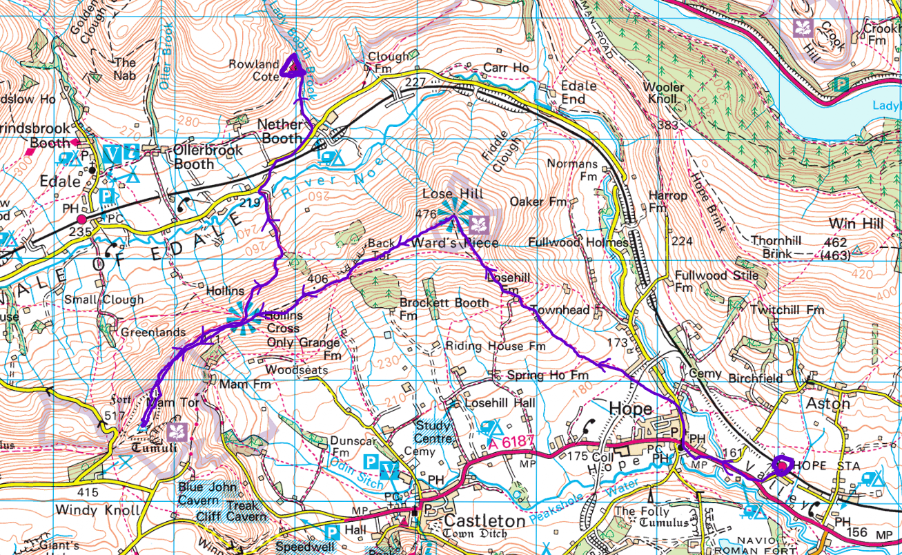
I had intended to start my hike from Edale but I had forgotten to pack something for tea so I got off the train a stop early as there is a shop in Hope. Here’s a map showing the route I took to walk from Hope to Losehill and then continuing along the ridgeline towards Mam Tor before heading on myself to Hollins Cross where I then descended towards Edale Youth Hostel.
This may not seem as long as my usual hikes but it is winter and the days are short …and maybe I overslept! It’s nice to do a normal-length walk sometimes, anyway. The weather was absolutely stunning while I was up in the Peaks and I was very lucky as only the week before we had severe floods everywhere around Nottingham and Derbyshire. Leaving Hope village and heading onwards and upwards to Losehill, here’s how fab the weather really was - snowy on the top and dry? A major win while in the peaks!
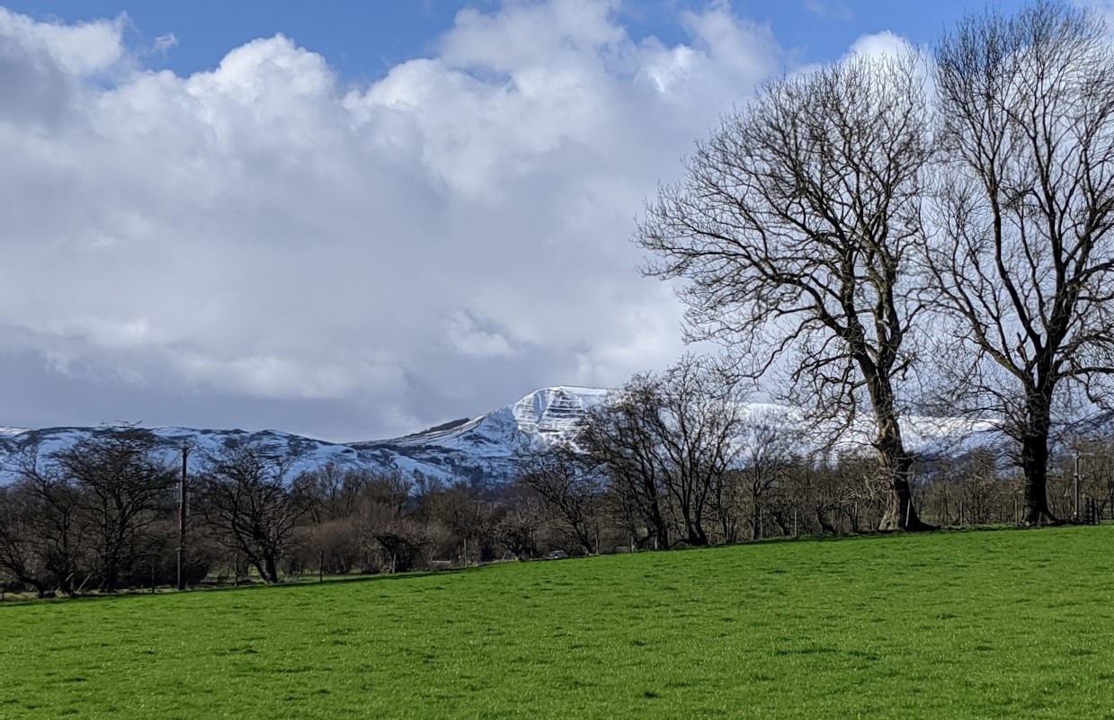
Here you can see Mam Tor in the background looking sunny and snowy. As I ascended, I started to walk in the snow - I love snow! Snow is fun and dry but I soon realised that walking in deep snow is quite difficult!
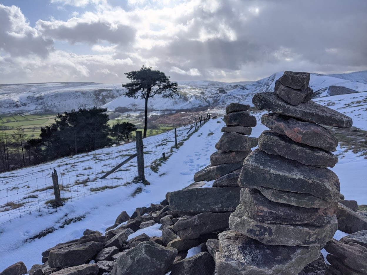
Up on the ridgeline, there were numerous spots where the snow went above my knees making it 10x harder to walk than usual! I had a lot of fun though and the views from up there are great. Here’s a pretty Cairn near Hollin’s Cross:
The ridgeline marks the divide between the White Peak and Dark Peak areas, so called due to the different geology and landscapes. The Dark Peak lies on the North side and has grit-stone, shale rocks and peat-covered slopes. The White Peak lies on the South of the ridge and is dominated by limestone rock, has a milder climate and richer vegetation. Cool stuff.
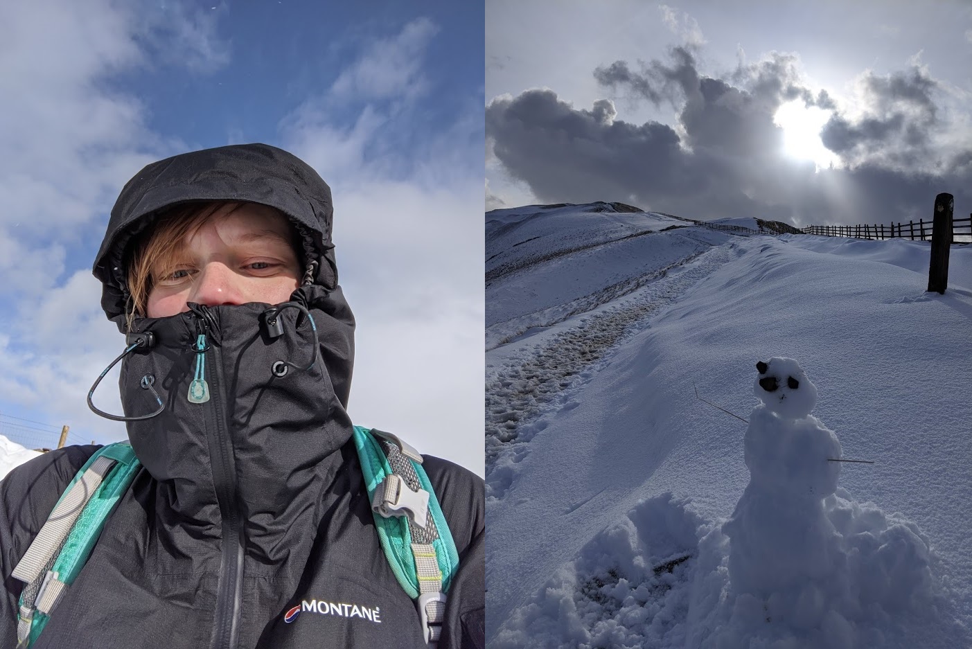
Moving onwards towards Mam Tor, the wind was starting to really pick up. Being the clumsy person I am, it felt quite unsafe when exposed to the full wind up atop Mam Tor. I had my coat zipped all the way up to help stop the wind slapping my face but still ended up looking quite red the next day. I managed to just boop the trig point before moving back on myself back towards Hollins Cross. But not before making a little snowman! (snowmam?)
Then from Hollins Cross I walked down into the valley and over to the Edale YHA to spend the night. YHA hostels are absolutely fantastic for solo travelling and make it very cheap and easy! I can bring something simple to cook or buy dinner, during the week it can be less than £10 a night and I don’t have to struggle to find a campsite nor carry camping gear. So much easier! I was lucky enough to have an en-suite dorm to myself (and wi-fi reached my bed!) but it’s also nice to chit chat with others in the kitchen and whatnot.
Day 2
I have no photographic evidence for this but in all honesty, I was woken up by a bird tapping its beak on the window. I can only imagine it usually gets some treats from the YHA workers or something! Besides, I felt like Snow White or something - probably my favourite way to wake up in the morning! Once out of bed, suitably breakfasted and packed up, I was met with this view from the front steps of the hostel:
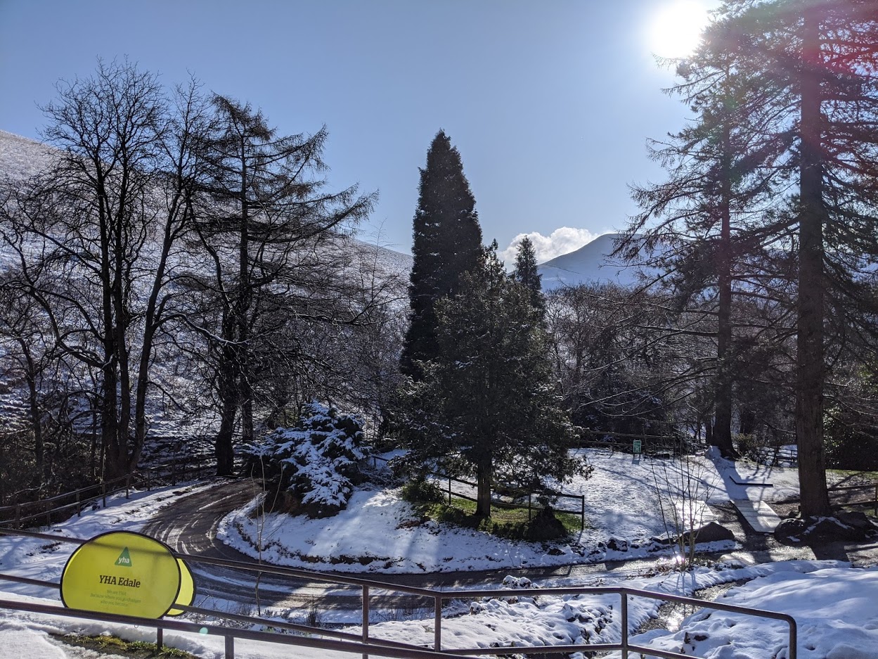
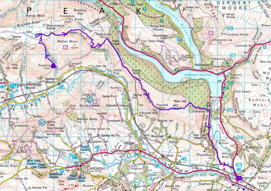
Beautiful blue skies, fresh snow on the ground and even clear hill tops! With it being snowy, I didn’t think Kinder would be on the table as an option but with the clear open skies - even up there - I had to give it a go! Here’s my route I took for my second and final day of walking:
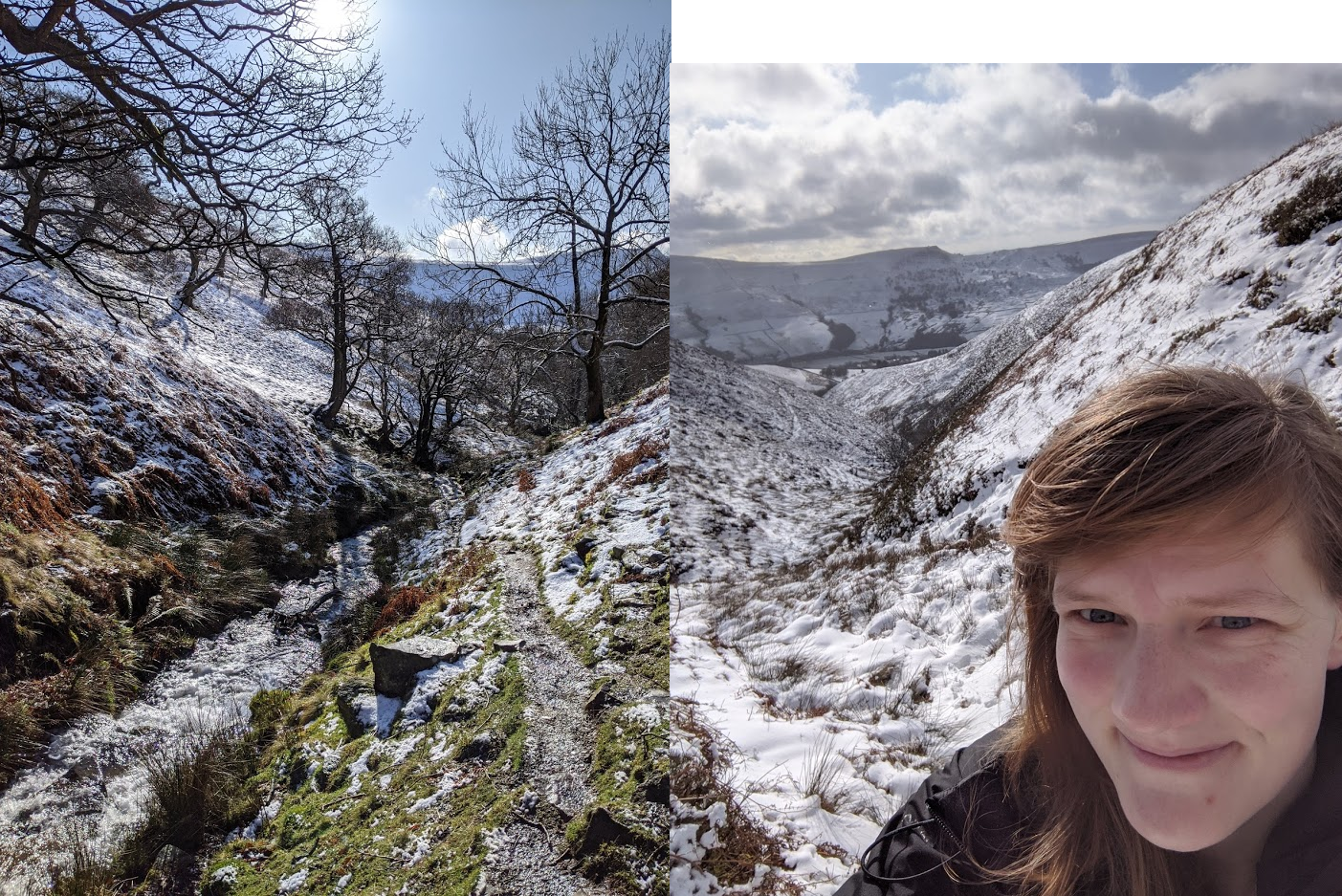
There’s a footpath along the brook behind the hostel that provides a very direct route up and on to Kinder Scout. Or at least that’s what I thought. As I gained height, there was more and more snow on the ground and so it soon became very difficult to find the path. Below shows the path beside the brook on that super sunny morning and right shows my silly face with the snow beginning to get thicker on the ground further uphill.
After completely losing the footpath, I made my way up on what I thought was maybe a path while trying to not step too much on the heath. Near the top, it was horribly windy and the cold snowy wind was quite painful on my face! However, the view over the valley was stunning!
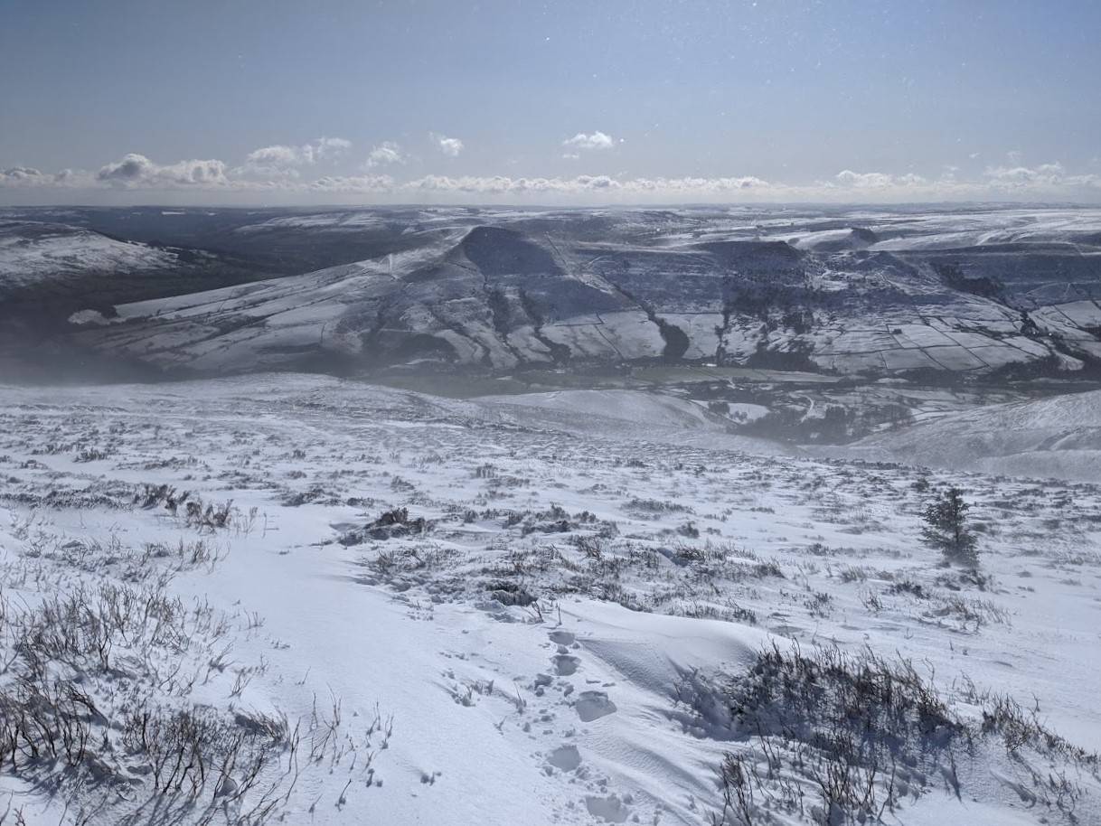
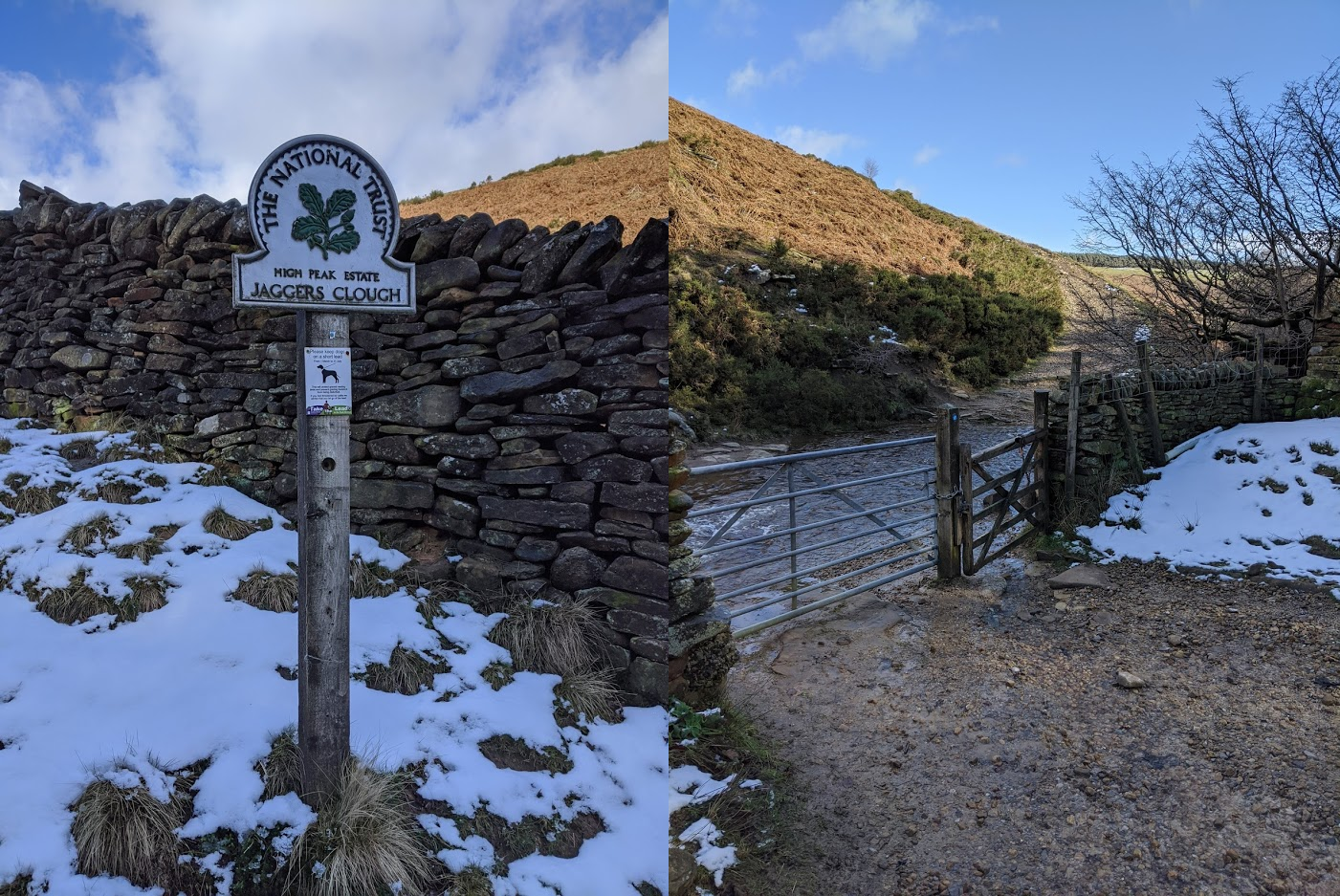
From here, I was hoping to reach the trig point but the peat pits were so full of deep snow, so it was completely unsafe to do so alone. I then thought to reach Madwoman’s stones but despite their fitting name for such a task, with only hiking boots and gaitors, it wasn’t a good idea! So, I thought about the best way of descending in the direction of Ladybower reservoir (since the reservoir always makes for a nice easy walk) and I was pretty tired after walking through all the snow. Perhaps it would have been more advisable to return the same way I came… Instead I tried finding the footpath but had no luck, even after finding a post it was hard to see the next one. After many failed attempts, I decided I’d scramble down Jaggers Clough which sounds super risky but at least I could see where my footing was as the rocks were exposed.
I didn’t snap any pics while scrambling down the clough as my hands were gloved (lots of falling in the snow…) and I had to focus quite a bit on not hurting myself. In retrospect, this was a stupid thing to do solo. It would have been far too easy to slip and break my ankle. After refinding my position on the map and making my way down to the edge of the woods at the bottom of Jaggers Clough, I was met by a pretty bridlepath that goes up to Hope cross. I just had to traverse a river at the bottom of the path left over from the previous week’s floods!
I was much happier on this easy bridlepath surface than scrambling down the snowy slippy clough. Then heading up to Hope Cross - which is super cool in itself. I don’t think I’ve been there before, which is always refreshing!
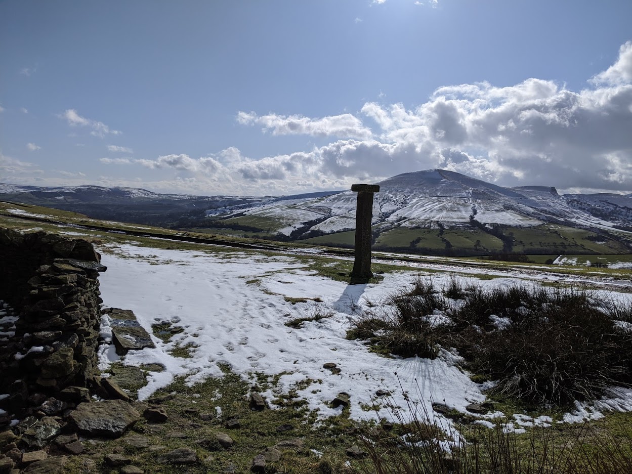
Once on the roman road, walking was easy peasy! Super flat, well-signposted and took me all the way to Win Hill! From there I was rewarded with a great view over Ladybower! Isn’t the peak district fantastic?!
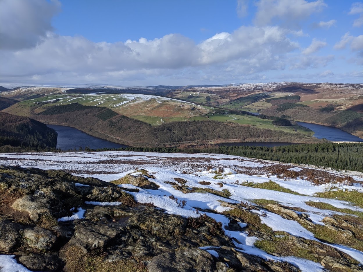
From Win Hill, I made my way down on to the Derwent Valley Heritage Way (another nice easy path!) which took me more-or-less to Bamford station. From there I took the train back to Nottingham and rested my weary legs! A fab little trip for a mini-getaway in February and a much-welcomed thesis break for me!